
The Great Marsh of the Indiana Dunes: Swamp-Walking in the Indiana Dunes State Park
May 23, 2013
If you look at the history of humans in the Indiana Dunes
area, you will not see much record or evidence of habitation in the early
years. Mostly, Native Americans, French
fur traders and others passed through this area just to hunt, fish and forage,
not staying long in this land of sand, swamp and fierce lake winds.
A swamp is not an easy place for a person to live, but it
teems with a great diversity of wildlife.
My husband and I had walked the whole Cowles Bog Trail last year,
traveling through five different ecosystems.
The bog is about in the middle of the Great Marsh.

map overview of lake shore in the Indiana Dunes
You can see it on this map of the lake shore, situated between
Indiana Dunes State Park and the Port of Indiana. You can also see how the Great Marsh
stretches from Gary in the west to (almost) Michigan City in the east. And, you can also see how industry drained a
good-sized chunk of the Great Marsh and carved it out for roads, mills and
other buildings.
But, on this day of May, Richard and I were not exploring
Cowles Bog, the Port of Indiana, or even the beach. We wanted to go swamp-walking on the trails
of the Great Marsh that lie within the boundaries of Indiana Dunes State Park.

map of Indiana Dunes State Park
In this map of the State Park (above), you can see the Marsh
(swamp) in the middle left of the Dunes Nature Preserve, just to the east of
the really busy part of the park.

overview exhibit of natural features of Indiana Dunes State Park
Compare the State Park map with this exhibit in the Indiana
Dunes State Park Nature Center. You see
basically the same thing, but with emphasis on the natural features. Roads and trails are evident, mostly through
forested areas. The blue line at the
top, Lake Michigan, is bordered by the tan shoreline and foredunes. Tan spots that insert farther from shore into
the green spaces are sandy “blowouts”.
And in the middle of all of the green, it's easy to see where
the Swamp is situated, nestled in that low area between the old Tolleston and Calumet Beaches (see
previous Great Marsh blog entry).
Notice the trails going around the swamp. That is where we will walk.

detail of Indiana Dunes State Park trails map showing Great Marsh trails
We are going to start at the Nature Center and take the
Nature Center Trail to Trail 8. Here, we
will go across a short boardwalk across Dunes Creek (the very same creek that
empties into Lake Michigan to the north), and will end up near Wilson Shelter,
where we will veer southeast to meet up with Trail 2.
We'll wander Trail 2 through the forest, where there are lots
of ferns and wildflowers, and then veer northward on Trail 2 to take the long
boardwalk over the Marsh. We will meet
up with Trail 10 and take it to the west, then detour on the little side trail
that goes to the Bird Observation Tower.
We will then continue on Trail 10, heading westward close to the Marsh,
take a short dip south, follow Trail 10 westward again, and then flow right
into the Nature Center Trail, and back to “home base”.
Ready? It’s a long walk! Let's go!

The beautiful Nature Center at Indiana Dunes State Park.

Just outside the Nature Center: a garden of native plants that are found in these
woodlands.
We begin the walk on the Nature Center Trail, entering the
Dunes Nature Preserve.


Witch Hazel is a common shrub in the Indiana Dunes woodlands. This Witch Hazel leaf has a gall created from leaf tissue after a tiny insect laid its egg on the leaf.

Maple-Leaved Viburnum, also common here, just before blooming. Both this and the Witch Hazel will be blazing with color in the fall.

We start out on Trail 8.
The boardwalk over Dunes Creek is in the distance.

The very large and elegant Cinnamon Fern, with its spicy-colored fertile stalk in the middle. We will see many of these along the wet parts
of trails.
Royal Fern, also common in the Indiana Dunes wetlands, is to the left of it.

At the edge of Dunes Creek, along the Trail 8 boardwalk, Lizard Tail grows in the swamp.

Spatterdock (or Yellow Pond Lily), blooming bright yellow over
the water. Around it is the tiniest
flowering plant, Duckweed, which may look like algae from a distance.

Along Trail 8 – Arrow Arum lifts its great leaves above the
swamp water as tiny Duckweed floats on top. (Well, I say Arrow Arum, but there are a few arrow-leaved species and I'm having trouble telling the difference - I need to go see them again, with field guides in hand!)
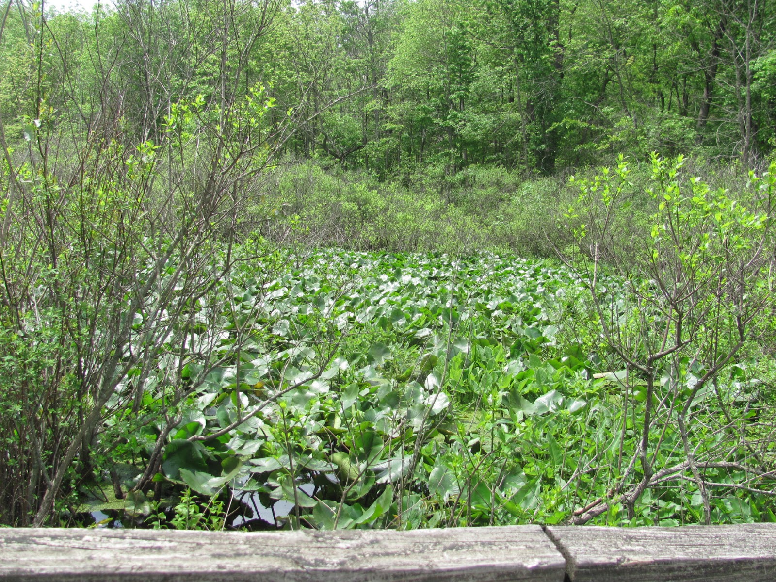
The density and lushness of plant life in the swamp.

This one is a mystery to me, and a mysterious looking flower
on this tree or shrub. I would love to
find out what it is!

Bracken Fern grows abundantly in the wet places.

Elegant Grape vines with pendulous stalks of growing fruit hang over
the swamp.

Dead Man’s Fingers fungus reaches up out of the wet ground below.
We now meet up with Trail 2.

A tiny wasp visits the blooms of Clustered Snakeroot.

Pale yellow blossoms dance up the flowering stalk of Swamp
Lousewort.

Wild Leeks, also called Ramps, with vibrant purple petioles.

Clusters of Squaw Root grow all along a good-sized portion of
wet woodlands along Trail 2, on the way to the boardwalk. Squaw Root is a flowering plant that does not
have chlorophyll, so it is not green.
Instead of converting energy from the sun into food, it feeds from tree
roots, particularly oaks.

Richard continues on Trail 2, stepping through fallen Dogwood petals.

Slugs love damp places.

We come across a collection of the very large shelf-type mushroom called Dryad’s Saddle. These are so large that it’s easy to imagine
mythical creatures perched on them.
We are reaching the Trail 2 boardwalk which goes across the
Great Marsh, and will be turning to the north.

These clusters of giant leaves are seen almost everywhere in
constantly wet conditions of the Great Marsh.
They belong to the Skunk Cabbage, which was the first plant to bloom in
late winter. It must smell very interesting here at that time of year.

The leaves and seed heads of Marsh Marigold in the swamp along
the Trail 2 boardwalk.

Lush swamp vegetation greets Richard as he travels the
boardwalk over the swamp.

Another wonderful swampy neighborhood scene. A Wood Duck house is mounted on a tree across
the way.

There are no obstacles for the many-legged millipede.

A swampy scene full of Sensitive Ferns.

Logs fallen into the swamp water become miniature
ecosystems. Rain makes shimmery ripples
on the swamp. We walk on, despite the
rain and the distant rumble of thunder.

The wet Trail 2 boardwalk, lined with a great variety of
plant life.

Standing at the edge of the boardwalk over the Great Marsh, I
encounter a number of plants I don’t know, growing out of the water.

These large shrubs, or short trees, hold rounded bunches of
waxy white flowers. I am not sure what
they are, but maybe Nannyberry, which is also called Sweet Viburnum, and related
to the Maple-Leaved Viburnum at the beginning of the Nature Center Trail.

A glowing swamp scene under overcast skies.

Along the latter part of the Trail 2 boardwalk. Different plants appear here, where there is
very little drainage or movement of water.
Debris from dead plants rots and collects at the bottom of the swamp,
making it more shallow and more amenable to reeds and grasses.

Nearing the end of Trail 2, we come upon an old tree with a large stack of Sulfur Shelf mushrooms.
We now turn westward onto Trail 10. It is hard to believe that, to the north of
us (our right), there are dunes! We will
be walking through wet woodlands and a bit of swamp.
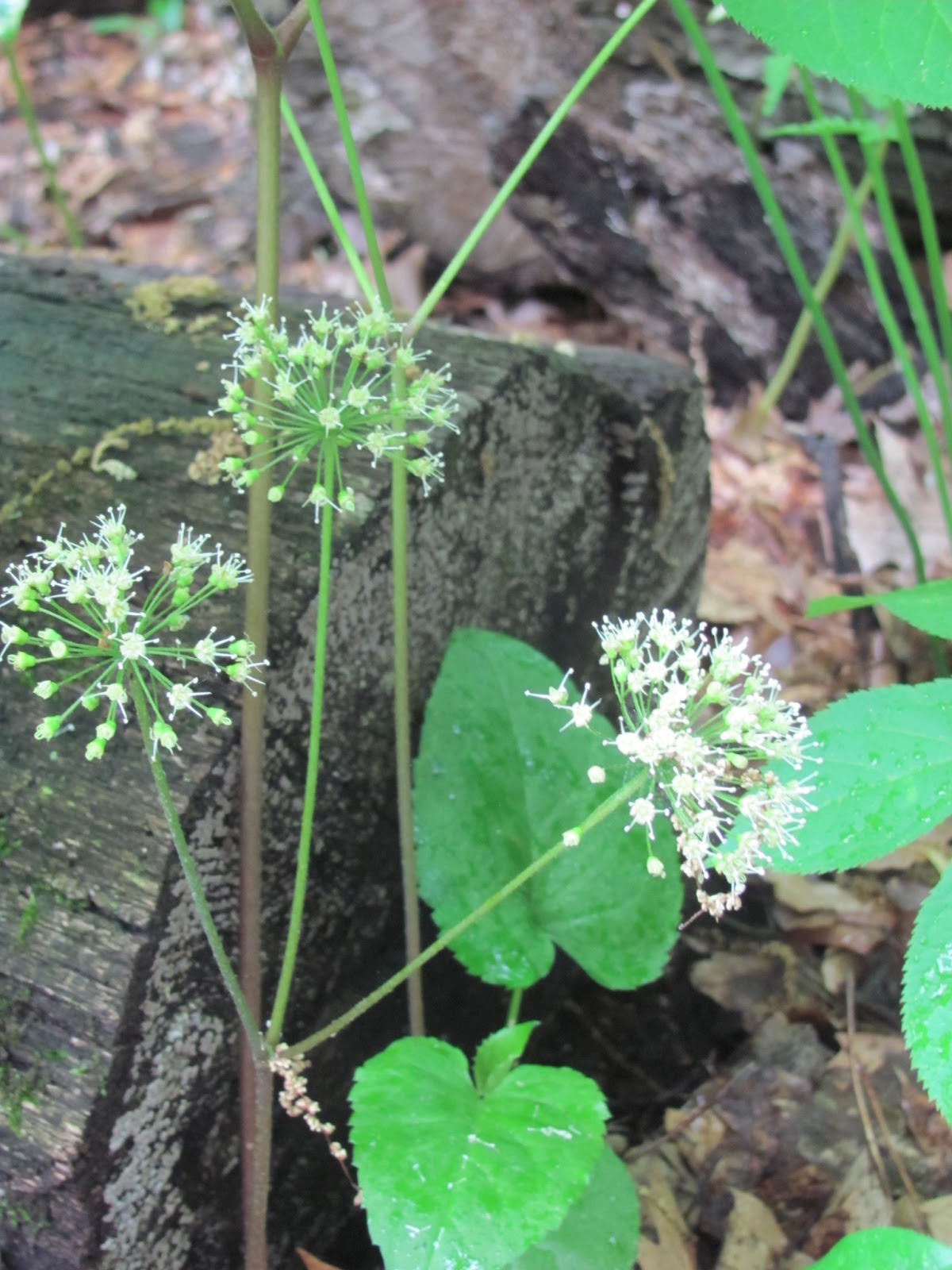
Wild Sarsaparilla blooming along Trail 10. This is one of my favorite plant names. I imagine Yosemite Sam exclaiming “Well, I’ll
be a Wild Sarsaparilla!”

Richard ambles along on Trail 10. We are headed to the side trail that takes us
to the Bird Observation Tower.

The side trail to the Bird Observation Tower, drawing us in
through the dappled light of woods and
swampy places.

A noble stand of Royal Fern, arching from its thin, dark
stems, rises right out of the water.

To the top of the tower – peeking through the trees.

What a view!! This is from the top of the tower, looking
straight ahead. We are looking across
the Great Marsh. The woods on the other
side are where we walked the long part of Trail 2 before the boardwalk. It looks like a long way from here.

From the top – looking to the east across the Great
Marsh. Beyond this is the boardwalk.

From the top – looking to the west across the Great
Marsh. This is where we are headed.

After leaving the Observation Tower, we continue westward on
Trail 10. We reach an area abundant in
blooming Wild Columbine

It’s time to check the trail map…

We now enter the Prescribed Burns area.

Frequently, we see drifts of Canada Mayflower in bloom on the
forest floor. This plant is also called
Wild Lily-of-the-Valley.

We are nearing the end of Trail 10. Things are looking a little different.

Here we see evidence of fairly recent prescribed burns. And here is where Trail 10 meets up with
Trail 9, which has wound its way over from the dunal areas.

A wild gooseberry shrub is starting to bear fruit.

And here we are – back on the Nature Center Trail, almost to
home base!

We hope you enjoyed out Great Marsh walk with us. Please visit Indiana Dunes State Park and
experience these trails - during any season.
Stay tuned … the third installment of The Great Marsh of the Indiana Dunes will
show up soon, when we will walk a new trail in the Indiana Dunes National
Lakeshore area, in an area that is being restored to its former self ….


