Friday, November 14, 2014

Coffee Creek Park


(Unfortunately, I have lost the photos taken during this walk. Fortunately, I had posted a good number of them into a Facebook album before they were lost, and was able to download those and use them in this blog post. This problem also delayed the publishing of this entry.)

Coffee Creek Park
Chesterton, Indiana
May 29, 2014

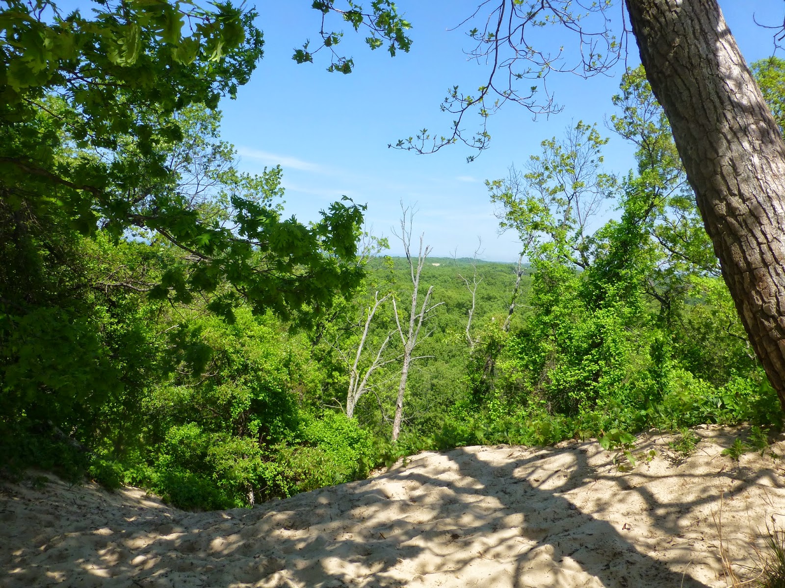
We had visited the Indiana Dunes again, and we had accomplished the 3 Dune Challenge.
It was then our day to, reluctantly, leave.
We went to downtown Chesterton for a casual, leave-taking lunch at Peggy Sue's Diner, where Richard had the “Cadillac Burger”.

After buying a wonderful old picnic basket at an antique shop, we drove around the block, still reluctant to leave. We came upon a sign, "Coffee Creek Park", adjacent to an area that seemed so lush, green and natural for a spot so close to downtown buildings. So, we needed to investigate, before heading south on Highway 41.

Coffee Creek Park is a city park of wetlands, woods, creek and boardwalk trails, snugged right up against the back of Peggy Sue's Diner and other downtown establishments. It could be confused (as I did at first) with Coffee Creek Watershed Preserve, which is a 157-acre area a mile from the city park. We will explore that one another time.

Coffee Creek, the color of cafe au lait, winds importantly through Chesterton but, strangely, was not shown on the map of Chesterton that we possessed. Coffee Creek Park and Coffee Creek Watershed Preserve were also missing from said map, which is why coming upon one of them was a serendipitous experience.
We were to discover that the city park represents a very lovely balance between recreation, nature appreciation and preservation, and I would consider it a model for other city parks which either possess natural features or could develop them.

The first scene from the parking lot was a small, neat playground, at that time being enjoyed by a few young mothers and their small children.
We proceeded on the trail to the left of the playground and came to the first bridge.  

  Classic wetland: Cat-tails and Willow trees

 
The first boardwalk trail ...


I felt enticed to continue when I saw the boardwalk curving and disappearing through the vegetation.

As in many places, the keeper of this park must struggle with the onslaught of invasive species. In the background, a dense stand of the tall, intensely invasive Phragmites australis (Common Reed) was fronted by a swath of Cat-Tails, a native plant that, depending upon species, can behave as an invasive. However, Cat-tails provide nesting space, protective cover and food for many kinds of wildlife and have been used in a number of ways by Native Americans.

I loved the artistry of the many bends and turns in the boardwalk trail, which kept us high and dry and prevented us from disturbing habitat. Another part of the boardwalk trail can be seen in the distance, as it winds sinuously throughout the park:


Nice, metal-sided bridges on the trails provide safety without cutting off the view of the creek. A small child can still watch ducks, snakes, dragonflies and other creek animals.


It was wonderful, the way these boardwalks took us through different habitats …

 
 … including swampy places.


I wondered how many acres this park covered. It had to be a small place, yet it felt so quiet and removed in many places.

The planning of these trails also amazed me. The way the boardwalks wound around here and there, we could cover more distance and see much more. It was very creative and well thought out.
Here is a view from one bridge, looking toward one from a previous photo.

 
The creek was very slow in most places that day, so that trees were mirrored in the water. The “islands” of habitat, reflections, bridges and the winding creek and trails reminded me of Japanese gardens. Maybe the planners were inspired by those.


Unknown plant


            Great Willow trees on a peninsula


 Maple-leaved Viburnum in bloom


Red-Winged Blackbirds, common in wetlands, were flying and calling around us with their swampy-sounding “ker-pe-cheeee!”


  Purple-Stemmed Angelica, a.k.a. Great Angelica (Angelica atropupurea)
I had never seen this large, striking plant before.

Possibly Cow Parsnip (Heracleum maximum), related to Angelica.


There is a place in Ouabache Trails Park (near Vincennes, Indiana) that desperately needs a boardwalk to protect wildlife habitat and help people cross over the wetland. Here at Coffee Creek Park, I found many construction elements that could be adapted to Ouabache Trails.

We spotted the first gazebo, which was a nice surprise. What a nice spot for meditation, conversation, or lunch. It, too, seemed to be inspired from Japanese gardens.


  Boardwalks lead to and from gazebos

Then, we needed to see what that wooden area was beyond this gazebo.


Lo and behold … a horseshoe arena! Complete with judges' tables and lighting. This was another unique way to sustainably blend recreation with natural surroundings. I also liked the way the boardwalk skirted the edge of the arena, blended but separate. This arena was very near a parking area behind downtown buildings – another way to enter and enjoy the park.

Lastly, when the boardwalk trail turned to regular dirt trail, we came upon this lovely fishing


 American Lotus plants flourished with their roots in the pond's muddy bottom. A man was fishing nearby from a lawn chair.

 
 A male 12-Spotted Skimmer dragonfly (Libellula pulchella) settled near enough for a photo, wings glimmering in the sun.

The trail in the sun would wind around and take us back to the official park entrance, where we began.

If I lived in Chesterton, I would certainly frequent this very accessible yet remote-seeming place. It is one of the aspects of this town that make its residents very fortunate.


Wednesday, October 1, 2014

A Trail Through History and Nature


A Trail Through History and Nature
Fort Knox II State Historic Site
Vincennes, Indiana
September 18 and 19, 2014
 
 
Most often when I am conducting youth programs these days, I am bringing them to a connection and understanding with the natural world. Sometimes that path crosses with human history.
I live in an area very rich in history and historical sites. In fact, I used to work as an interpreter for the Vincennes State Historic Sites, a complex of many things, including an old print shop, a replica of the first Indiana college, the Indiana Territorial Capitol building, a prehistoric mound, and an early 19th century fort site.

On a Thursday and Friday morning in mid-September, natural and human history blended at an event called A Day in the Life of Fort Knox II. Eighth grade students from three area schools came to the site to learn about life at Fort Knox II and life on this early western frontier.

My part in this was Plants. I have been doing Plants in this event for many years, and have tried various angles. This year, I simplified my program and taught the medicinal and food uses of a small number of garden herbs, wild plants and native trees. We would have each group for about 15 minutes.


Here is my little table at the beginning of the first day. By the end of each morning, the herbs did not look this fresh at all. Students were allowed to handle and smell the herbs as I spoke about them. There is nothing like the olfactory sense to create experience and memory, added to tactile and visual experience with the herbs.

On the left corner are Peppermint and Spearmint for flavor, fresh breath and, especially, tummy ache. In the middle is Lemon Balm, good for practically anything. Even the scent of mint or Lemon Balm helps people to feel better. On the right corner is Sage, the herb of wisdom and strength. It is also good for treating headache and sore throat, among other things. Behind the Sage is Horehound, especially good for cough, sore throat and minor respiratory problems. The students also learned about the importance of knowing the herbs and how to use them on the frontier.

The gourd is on the table to teach about pioneers transporting garden seeds from their previous home to a new place, while traveling many miles through wilderness. A gourd is a good seed-keeper – seeds are more likely to germinate in the new garden after traveling in a gourd. It was very important for the pioneer to have food and medicinal plants that were very familiar to him or her when settling so far away.

The 8th graders also learned the importance of understanding wild plants. Behind the gourd, bedraggled at the end of summer, is an especially important and versatile one called Stinging Nettle.

  Nettle growing in wet woods

All of those little hairs along the stem and leaf veins contain a compound of acids that include formic, the same acid injected by an ant bite. When you brush against the plant, the sharp hairs inject this compound into your skin, immediately leaving you with a prickly, itchy rash that goes away awhile later. Some of the students said they had experienced this before. Cooking or drying the plant neutralizes the acid, taking away the sting. Stinging Nettle, when younger, is cooked as a very healthy vegetable or steeped in water as a tonic. In the fall, twine can be made from the fibers in the stem.

Another tonic the students learned about is in the first native tree we approached – Sassafras. The red spot on my table is one of the early-changing leaves from a nearby Sassafras tree.

 Red Sassafras leaves

The 8th graders learned to recognize it by its three leaf shapes (oval, mitten and three-fingered) and by its scent. They all seemed to enjoy smelling the citrusy scent of scratched green Sassafrass twigs.


They also learned that a tonic, made from the roots, is the “original root beer”.

Moving further along the edge of the woods, we found a Paw-Paw tree.


This one was too young to bear fruit, but there were a few students and teachers (more from the country schools than from the city school) who could describe the flavor of the “Indiana Banana”.

Our next native tree encounter was with a Persimmon tree loaded with fruit.


There were a few students who had tasted native (not Oriental) persimmons – again, mostly from the country schools. None of the fruit was fully ripe at that time. They learned that it is not fully ripe until it is soft and falls to the ground. If eaten not fully ripe, there is an experience in the mouth that one does not forget.

Sassafras tea, Paw-paw fruit and Persimmons: historically an essential part of the Hoosier experience, particularly in autumn. Year after year, I am disappointed by how few children have tasted these. Picking up a Paw-paw (and putting it in your pocket), or Persimmons, then eating them fresh, is unforgettable. Or, pick up many Paw-paws and Persimmons for someone to turn into puddings, breads, pies and cookies. A decoction from Sassafras roots can also be made into a uniquely tasty candy. I always hope that the 8th graders I meet each year will eventually try these foods, after being brought to awareness about them, and they will taste history.

Other presentations at the event were quite varied. Students learned and tried many other things new to most of them. Another station where history and nature obviously met was one about animals on our early frontier.


The 8th graders also learned about Native Americans during this historical period. The lives of Native Americans were closely linked with nature in many ways.


Other historical presentations during the two mornings included:

 The ancient skill of Archery

Surveying then and now

 The life of an 1812 soldier at Fort Knox II

 The life of a soldier's wife (Lydia Bacon) at Fort Knox II


Mustering the troops


 A visit with William Henry Harrison, Governor of the Indiana Territory


When I was not with a group, I meandered along the woods' edge.
Goldenrod and White Snakeroot were in bloom.


Goldenrod has a number of medicinal uses that must have aided the pioneers. But White Snakeroot is known as the plant that caused the death of Abraham Lincoln's mother, Nancy Hanks Lincoln. She died after drinking milk from cows that had eaten White Snakeroot.
Students at my station also learned the importance of understanding if a plant is dangerous to our health.

Orb-weaver spiders sat in the middle of large, glistening webs:

 You can see the spinerettes on this one!

When disturbed, they tended to scuttle away and hide in nearby leaves.


Other insects were camouflaged in the leaves, such as this pale Leafhopper under a Sassafras leaf:

 
I have been to the site of Fort Knox II many times over many years. I have been involved in A Day in the Life of Fort Knox II for so long. I have also visited or been involved in, for many years, Muster on the Wabash on the first weekend in November, when the event backdrop is a blaze of the wonderful colors of an Indiana autumn. I have simply strolled the grounds, finding what trees are all around, seeing what is blooming or in fruit, looking for the little things, or spying the larger animals such as deer, foxes and turkeys. I have just rested on a seat overlooking the hillside and river, imagining voyageurs, Native Americans and others plying the water in various kinds of boats.


So much history has happened here on this hill above the Wabash River. In so many ways, people were affected by the natural environment here, and also had their affect upon it.

It is now a peaceful place, devoid of the activity of soldiers, the sounds of gunfire, the agony of injury and death, the terrible excitement of heading north for battle. That human history is now interpreted for visitors, while natural history continues, going about its business. It has been a long time since this place has been affected by the battles waged by human beings, but the struggle of everyday life in the natural world, predator and prey, survival, competition, goes on, mostly unseen by human eyes.


Thursday, July 31, 2014

We Did It! The 3 Dune Challenge


We Did It! 
The 3 Dune Challenge
May 29, 2014


Indiana Dunes National Lakeshore Visitors Center:
We were standing before a large map of the whole Indiana Dunes area, staring at different locations, tracing various trails and pondering what special thing we would do during this trip. Every time we go to the Dunes we try something different, hike a different trail or two, or explore another place. Should we return to a favorite trail from the past, such as Cowles Bog? Should we re-try the one where we got lost (Li-Ko-Ki-We, cum Dunewood Trace) and get it right this time? Or should we try one of the trails we haven't experienced, such as the West Beach or Miller Woods Trails?
A very friendly guide came over to help us. That was when we found out about the brand-spanking-new “3 Dune Challenge” - walk trails in Indiana Dunes State Park between and to the tops of the three highest dunes: Mt. Jackson (elevation 176 feet), Mt. Holden (184 feet) and Mt. Tom (192 feet). I did have a goal of going to the top of Mt. Tom this time, so why not all three? Richard agreed that we should take on The Challenge.
The official kick-off for the 3 Dune Challenge would not be until Tuesday, June 17, and it would be quite an event. We would not be there on June 17, but the park service already had the Challenge set up. Another plus was that it would be cooler on May 29. From my experiences scrambling up and down these steep, sandy places in my younger days, I knew I preferred not to do it on a hot day.
So, off we went, state park map in hand.
What we didn't know at that early date was that the “official” Challenge is a designated 1.5 mile trail route. Not knowing this, we chose our own route, to visit each dune in a different order. It didn't matter – getting to the top of each dune would be a big accomplishment for us, and we looked forward to the spectacular views.


Indiana Dunes State Park, at the southern tip of Lake Michigan, is approximately halfway between Gary and Michigan City, Indiana, surrounded by Indiana Dunes National Lakeshore properties. It extends from lake shore and beaches, through dunes and forest, and back to the swampy places between two dunal areas. Some of my childhood was spent on the beaches, dunes and trails here, making wonderful memories. My blog entry of July 2, 2013, “The Great Marsh of the Indiana Dunes: the Backstory”, gives a good background on the geologic history, formation and physical characteristics of this land.

   Map of Indiana Dunes State Park 

In late May of 2013, Richard and I walked all around the Great Marsh in the state park, reported in “The Great Marsh of the Indiana Dunes: Swamp-Walking in the Indiana Dunes State Park”, posted on July 14, 2013.
This time, we would have a much drier walk.

  Map of state park, with three tallest dunes highlighted.

We decided we would not tire ourselves at the beginning by taking Devil's Slide or the beach straight up to Mt. Tom. We would start at the Nature Center, take Trail 7/8 to Mt. Holden, back-track a little, take Trail 8 to Mt. Tom, back-track on Trail 8, go south on Trail 7, cut over to the eastern part of Trail 8, then take that to the top of Mt. Jackson. We would go back down Trail 8, cut back over to Trail 7, and back to the Nature Center. This was definitely more back-tracking than the “official” trail.

After a brief stop in the Nature Center, we started off nearby on Trail 7.  Off we went on the sandy trail through shady woods.


We were fortunate to be at the Dunes during this time, when there are beautiful blooms.

  Lupine (Lupinus perennis) along Trail 7


 Blueberry (Genus Vaccinium) Probably either Highbush/Swamp Blueberry (V. corymbosum) or Dryland/Late Low Blueberry (V. pallidum)


 Maple-Leaved Viburnum (Viburnum acerifolium) in bud

 Sand Cress, or Lyre-Leaved Rock Cress (Arabis lyrata)
 
A walking stick would be very helpful.

   Richard on the trail

Our first ascent was up the side of Mt. Holden. I found some of my favorite dune-loving flowering plants here.


Hairy Puccoon  (Lithospermum caroliniense)

Possibly Butterfly Weed Milkweed (Asclepias tuberosa)


  Common Milkweed  (Asclepias syriaca)

  Wild Grapes – don't know the species (Genus Vitus)

I did not know what this was, as it was not blooming yet, but it looked a lot like Cosmos:


And – we reached the top!

 Mt. Holden 184'


The view from the top of Mt. Holden, including Lake Michigan:


Richard's walking stick became a “dowsing rod” to find the lake. 


Back down Mt. Holden – our muscles were warmed up. I thought about how different it is to climb up sand instead of a rocky or forested slope. There is often nothing to hang onto, and every two steps forward result in one step back. I had read that, in some parts of this area, slopes are nearly 40 degrees.

 I remember some very laborious climbs, on all fours, in my earlier days, followed by fast, exhilarating descents down the other side, when my legs, like those of a cartoon character, would wheel and propel non-stop as if on their own.

Walks through breezy, shady forested trails were nice respites between the dunes.


 Richard resting on an old tree on Trail 8, between Mt. Holden and Mt. Tom.

  Native Columbine (Aquilegia canadensis) ….

...and more Lupine in bloom.

  The last of the shady trail to Mt. Tom


We reached the base of Mt. Tom, the tallest dune. 


  On the way up Mt. Tom …


 … to the top …


 … where I am greeted by a little friend.

 Top of Mt. Tom: elevation 192 feet

Views from the top of Mt. Tom, panning east to west:


 Looking east toward Michigan City   


 Looking north

Looking westward – steps going down the other side of Mt. Tom toward the lake shore and Devil's Slide. I want to go that way sometime.


Zooming in westward on the Burns Harbor area


Some geologic history:


5,500 years ago, the lake was all the way up here, at the “Tolleston Beach” level. Earlier, at the “Calumet Beach” level and the “Glenwood Beach” level, we would be under deep water.  Retreating and advancing glaciers caused lake levels and shorelines to change. Ridges, still visible in the Indiana Dunes landscape, are the remaining evidence of various ancient lake levels.


After spending time taking in the spectacular views, it was time to descend Mt. Tom and head to the next, and last, destination.  


  Interesting mushroom on Trail 8


More walking in the cool shade:


 Dramatic tree roots exposed after sand blew away

Starry moss

We reached the bottom of Mt. Jackson and gathered steam for our last ascent.


Climbing up Mt. Jackson was the most difficult, despite being the least high in the 3 Dune Challenge. The sand “trail” became very wide, and it seemed to take so much more time and effort.


 “Every two steps forward result in one step back”

We reached the top of Mt. Jackson, at 176 difficult feet above sea level!

(By the way, that's not our beer can, but we wondered how someone got it on top of that pole.)

 
Views from the top of Mt. Jackson, which is further back from the lake than the other two dunes:

 Looking northeast – the other side looks steeper. What is that light spot in the distance? 


 Exposed sand. Could this be part of the Beach House Blowout? It is hard to tell from here.

 Looking eastward toward Michigan City


 Zooming in toward Michigan City.


Looking northwest

It was time to go down Mt. Jackson, which would, undoubtedly, be more fun than going up.


 Running down the steep dune, as I had years ago.


It was all downhill from there, and in the shade - a nice reward.

Heading back to the Nature Center

 Bracken Fern (Pteridium aquilinum)

  I don't know this plant, but it was pretty.

More dramatic exposed tree roots – a good place for fairies.

We Did It!

After returning to the Indiana Dunes State Park Nature Center for drinks of water and cooling off, we drove back to the Indiana Dunes National Lakeshore Visitors Center. There, we got a t-shirt that we earned the privilege of buying and got some free postcards and stickers.


In between the Nature Center and Visitors Center, we made a short stop at the lake and state park beach.


The Pavilion


Maybe one of our future visits will be taking the 3 Dune Challenge again, using the “official” route. But, not on a hot day.

For more information on the 3 Dune Challenge and the Indiana Dunes, check these web sites:

www.indianadunes.com/3dc   (includes a short video and a small map of the “official” Challenge trail)

www.ingov/visitindiana/blog/index.php/2014/06/17/3-dunes-challenge-indianadunes
(blog of Jake Oakman, reporting on the day of the official 3 Dunes Challenge Kick-Off)