Bluffs of Beaver Bend Nature Preserve, Redux: The New Trail
December 26, 2018


(Note: To learn about the geology and history of this nature preserve, see my first blog entry about it, from a walk on May 7, 2016, at: https://terriofthetrails.blogspot.com/2016/05/bluffs-of-beaver-bend.html .)
There are many places worth revisiting. Bluffs of Beaver Bend Nature Preserve, in Martin County near Shoals, Indiana, is definitely one. In fact, it has been referred to as a "crown jewel" in Indiana's nature preserve system. Considering the beauty and fascinating variety of natural features in the system, that is saying a great deal.
The first time I went to Bluffs of Beaver Bend (which was recommended by friends who had recently been there) was on May 7, 2016, when my friend Jen and I attended a scheduled, naturalist-led walk there. A good number of people were in attendance, particularly members of the Indiana Native Plant Society (at that time called the Indiana Native Plant and Wildflower Society). The leader was Ryan Keller of the Indiana Department of Natural Resources.
From the moment in May that we turned onto the road into the preserve, I was stunned by the soaring sandstone cliffs covered in lush vegetation. I did not know a place like this existed in my state. By the end of the walk, I knew I wanted to return, and that I wanted my husband Richard to see this place.
Well, time sure flies by, and it was near the end of 2018 that we finally got to do that. We wanted to go on a day-after-Christmas hike for the day (and we were definitely not getting an early start). Bluffs of Beaver Bend fit the bill.
There were several major differences between my first and second walk there. The first, obviously, was the difference in seasons, from warm and very green May to a cold and relatively stark December. Each season has its own unique beauty, though, and I looked forward to seeing this place in very different attire. I wondered how much plant and animal life the place would be showing, compared to spring.

A Bladdernut shrubs below the bluffs display a number of dry, bladder-like seed capsules

Winter decoration: old seed/flower heads of Wild Hydrangea
The second obvious difference was that I first walked with a group, and the group had a leader to bring our attention to certain aspects and answer our questions. This time, the only people there were me and Richard. There was no leader, unless one counts that I had been there before. But, since it was a new season I would see it through my own new eyes and also through Richard's fresh eyes.

Richard's first time experiencing the Bluffs of Beaver Bend
Another reason the experience would be very new was the next difference ….
…. we walked a new trail.
When I was there in 2016, the only route to walk was the little gravel road. This is a linear path extending between the White River and the base of the bluffs. One could only walk to the end of the road, turn around, and come back. And, the only views there are from below the sandstone bluffs, looking up at them. But, those are truly magnificent views, and one can spend much time marveling at the rocks with their soaring height, bands of color, and the holes, fissures and "caves" created by weathering, as well as examining closely the plant life clinging to rock and spread over the ground below.


What kind of wildlife might be sheltering in the cave-like holes of the bluffs?

The strongly aromatic Hairy Wood Mint persists through the winter below the bluffs
I had heard, somehow, that since the last time I was here a new trail was being created that traversed the area above the bluffs. I did not know if the trail yet existed, or was in-the-works, if we could use it, or even find it. That day, we had no information.
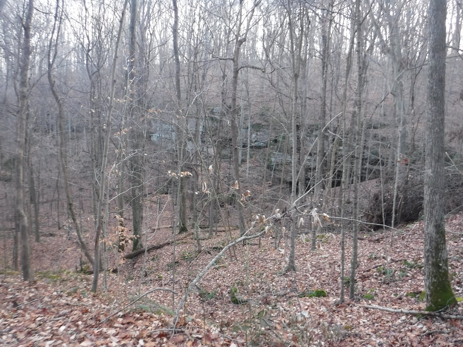
We pulled into the tiny parking lot before the locked gate and, as walkers are allowed to do, went around the gate and started wandering up the gravel road/trail. The rocks, though not covered as much with plants, were no less stunning than before. In fact, the bare trees gave us a much more clear view of the details of the rocks. We saw the rows of bluffs with their striated layers, as if a giant had spent years stacking thin tablets into piles. Brown vines hung down the cliff faces. Odd designs between the layers stood out, grabbing attention.


The bare trees also afforded us a more clear view of the grand White River to our right, with it's shining, bright water. We noticed the places where water running off the bluffs had carved paths to the river. Large chunks of sandstone jutted from the edge over the water at haphazard angles, as if that same giant had tossed them aside.

Richard, probably contemplating the catfish lurking in the river bottom


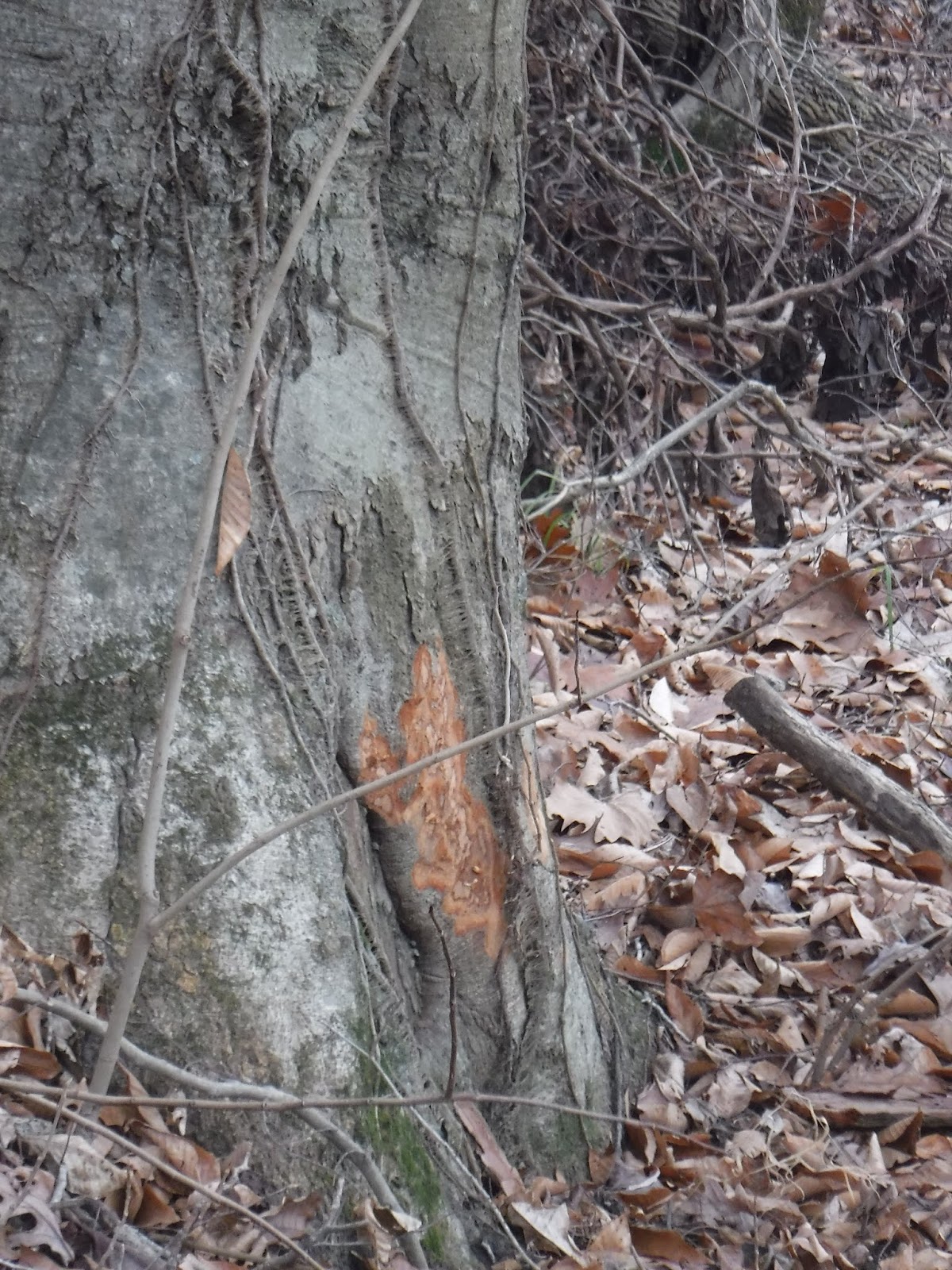
A deer had rubbed its antlers on this tree just above the river
We came to an opening at the base of a bluff, one that was unnaturally shaped, too regular. This was man-made, a gold-miner's "cave". I don't know how far into the rock it goes (or if anyone ever found even a smidgen of gold), but I wondered what wildlife must take refuge in there sometimes. The gold-miner's cave caught Richard's attention. Such a place can capture the imagination and send it in all sorts of directions.


Hanging above the cave, as if stuck onto the rock with thumbtacks, a few clusters of ferns drooped. Even in winter, some life tenaciously grasps the rock, or tiny places in it, remaining verdantly green.


We found other kinds of plants on the rocks, also. Some I had remembered from the spring walk, and it seemed surprising to see them still there, still green. Many were nourished and sheltered by the coatings of mosses, liverworts and lichen that are the first living forms to attach and flourish on rock surfaces, providing a substrate, a foundation, for other forms of life to take hold. Mosses hold water like a sponge, a place for both plant and tiny animal life to live.

Moss and blue-green lichen


Christmas Fern

A sedge, and a mushroom below


Wild Stonecrop growing in a mat of Liverwort
This also happened with old, damp logs on the floor beneath the bluffs.


Moss and ferns on a log
I was fascinated by the rich, diverse colonies of life on some of the rocks, all supporting one another. One rock stood alone, balanced on one of its corners, covered in shades of blue and green. Against the gray-brown surroundings, it looked more like an artist's sculptural installation.

This diverse colony on a rock resembles, I think, colonies of corals and other sea animals attached to the ocean floor


And, then, we found it … the start of a new trail. A few orange flags beckoned us gently upwards. "Hey, there IS a new trail!" "Should we try it?" "Sure! Let's go!"

Of course, we had no idea what we were getting ourselves into. The trail was brand-new. There were, as yet, no signs, no trail markers, no interpretation, no map or trail guide. Those were yet to come. But, we found that there were plenty of orange flags all along the trail, and there was never a question about where the next section of trail went. But, we did not know how long it would be, and the sun was getting lower toward the western horizon. Would we find our way back before the Earth had turned a bit too far?

Right away, barely up the slope, we found a spot of great interest, and I wondered if the trail-makers had planned it this way. We were able to be up-close-and-personal with the rock, able to examine interesting weathered features, a layer of sand collected at the base, and signs of wildlife. I reached out to feel the cool, gritty surface of the rock.


Raccoon track


A constellation of lichens and mosses

Spider webs

Someone had gathered materials for a nest
Higher we went, following the trail, turning now and then to see the broad white band of river and the narrow gray stripe of the road.

Rock became more rounded, somehow tamer, more tucked into earth, piled with the old fallen leaves. We found rivulets winding among some rock, on their way to cliff edges, ultimately to those eroded spots we had seen below, into the river.


And, then, there we were … on top of the bluffs!! We were looking down from the tops of those magnificent rocks, down on the shining water, and the bend in the river, and off to the town of Shoals some small distance from the opposite shore.


Is that a cannon, on yonder hilltop?

Looking into the bole of the "cannon"


Rocks ensnarled in the roots of a fallen tree


In this forest was a low, bronze-colored, feathery layer. These were the young American Beech, which hang onto their autumn leaves all winter.

Sometimes the trail took us closer to the cliff edges again (but never too close), where dense stands of ferns clung to the edges, and where we found ever-loftier views of the river and surrounding landscape. It is reported that this affords a good opportunity to see Bald Eagles, but we did not see any that day. In fact, it was a quiet day for wildlife, with the sounds of woodpeckers and a few other birds, and some squirrels rustling about.


Further along, seemingly farther from the bluffs, we entered dry-mesic forest - drier than a typical mesic forest, yet not really dry. There were still some chunks of rock here and there, but so fewer that the odd rock seemed almost out-of-place. However, the "odd rock" showed how close the bedrock was below the soft forest floor.


Shagbark Hickory

I don't know what kind of berries these are (Coralberry??) - but I hope it is something native, and not invasive

Puffball mushrooms


The trail led us in and out of mesic and dry-mesic forest, so we came across a variety of things, including this Cranefly Orchid plant.

A possible den created in the root system of a fallen tree

The sun getting closer to the western horizon! How much farther does the trail go?
The sun was getting lower, and we were starting to become concerned. How long was this trail? How much farther did we have to go? It wasn't the best place to try to take shortcuts, and we were completely unfamiliar with where we were. Sometimes the amount of rock increased, and we knew we were getting closer to bluffs - maybe the trail was taking us back? But, then it would switch us back into the forest again - or so it seemed. There were plenty of interesting surprises along the way.


Another native Indiana orchid plant - Puttyroot


Then, almost suddenly, we found ourselves moving downward. Striated rock faces appeared behind mounds of earth, jutting from a slope.


We were back at the bottom, looking up again at those magnificent bluffs. This time, we noticed a few more things in or on the rocks that we didn't see before.


Walking Ferns, so named because when a tip of a leaf touches the surface, it grows another cluster of leaves, which leads to another, etc.


Eroded remnants of Mud Dauber wasp nests

And, we still had plenty of sunlight left to walk up the road, back to the car. It was a great stretch-of-the-legs on a winter's day, during the holiday season. We had it all to ourselves. And we both wanted to return and walk the new trail during another season.

***********************************************************************************
We still wondered how long that trail was, and how it wound around the landscape. It was good to walk it first during the winter, when one has a clear view of the topography and can keep bearings more easily. In the summer, we would have much more trouble figuring out where we were, or even seeing the glimmer of the river from afar.
Later, I contacted Ryan Keller with questions about the trail. He responded immediately, saying that it is about 2.5 miles long (including the gravel road portion), that they are working on signs, maps, and trail guides (which we assumed, but it was good to hear), and that the trail was created by the Hoosier Hiking Council.
I then found the Hoosier Hiking Council's Facebook page to learn a little about them, and contacted them through that. They also responded quickly and told me a little about the trail, and that there would be an official dedication on April 17. They were glad to hear people were enjoying the trail. Best of all … they sent me a map!! I was especially excited about that because I wanted a visual representation of the route, to see what we had done. I was surprised that there really isn't much in the way of "switch-backs" - it just felt like there was. Perhaps it was the lowering sun that made us feel that way, whenever the trail took us away from the bluffs again.
Here is the map of Nubbin Ridge Trail:

Well, I think we will be back to the Bluffs of Beaver Bend Nature Preserve on April 17!
I'll be able to check out those spring ephemerals in the forest then, too.


 I had really wanted to see a map of the trail to get a picture of what we were doing while we were walking. Since we walked it "blind" and were unfamiliar with it, I wanted to see it in relation to the topography. Thanks again - and congratulations on a job well done on that trail.